GEOREAL spol. s r.o.

LiDAR point clouds

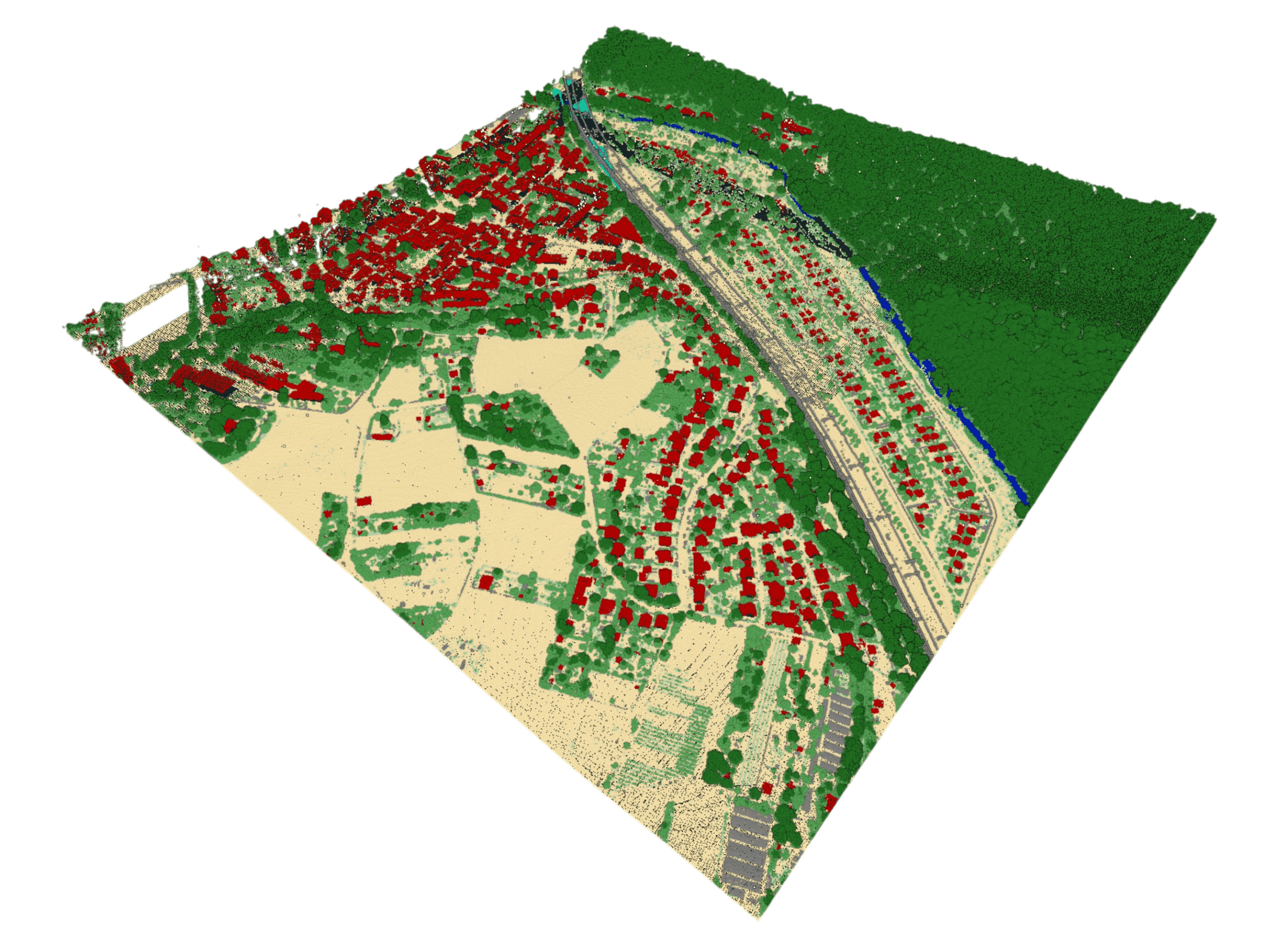
Airborne laser scanning gives us precise information about the elevation of an area – point clouds with a density of tens of points per m² and an accuracy of a few centimetres. The laser penetrates vegetation, so it captures the terrain even where photogrammetry cannot see.

Tens of points/m²Centimetre accuracyPenetrates vegetation
LiDAR point clouds

What it is for

Altimetry unhindered by vegetation

Airborne LiDAR measures the terrain with laser pulses from an aircraft. Some of the beams penetrate even dense vegetation – the result is a faithful terrain model in forest, scrub or tall grass.

Scanning produces a point cloud, which we classify according to the intended use: terrain, vegetation by levels, buildings, water surfaces and other classes. A classified point cloud is the basis for a digital terrain model (DTM) and a digital surface model (DSM), contours, profiles and hydrological analyses.

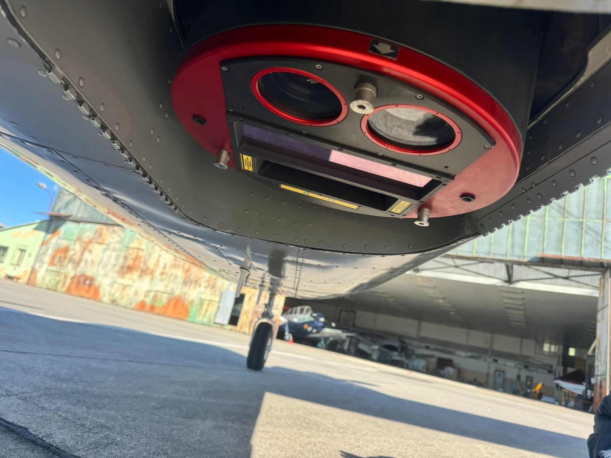
We scan with our own airborne RIEGL scanner; the density of the cloud reaches tens of points per square metre and the vertical accuracy a few centimetres. We design the flight parameters – density, season, combination with aerial photography – according to the purpose: the design of a linear structure needs different data than a forest inventory.

We routinely combine LiDAR with aerial photography in a single campaign – the point cloud is then complemented by an orthophoto, and the colour information makes interpretation and classification easier.

Altimetry unhindered by vegetation

Typical tasks

Where LiDAR excels

  • Accurate terrain in forested and overgrown areas

  • Base data for the design of linear structures

  • Hydrological analyses and flood protection

  • Forestry – stand structure and inventory

  • Detection of buildings and infrastructure

  • Combination with photogrammetry for maximum accuracy

Deliverables

What you can receive

Classified point cloud

Points sorted into classes according to the purpose – terrain, vegetation, buildings and more.

LAS / LAZ

DTM / DSM

Digital terrain and surface models derived from the point cloud.

GeoTIFF / TIN

Contours and profiles

Derived altimetry for design work and map products.

DGN / DWG / SHP

Intensity raster

An image of the intensity of returns for interpreting surfaces.

GeoTIFF

How it works

From flight design to data

  1. 01

    Design of the parameters

    We set the point density, the season of the flight and the extent according to the purpose.

  2. 02

    Scanning

    We survey the area with our own aircraft carrying a RIEGL scanner.

  3. 03

    Processing and classification

    We adjust the cloud, georeference it and classify it into classes.

  4. 04

    Checking and handover

    We verify the accuracy on control areas and hand over the data.

Common questions

What you ask us most.

The laser beam is reflected successively from the canopy, the undergrowth and the ground – we record several returns per pulse. Classification then separates the last returns from the ground, which gives a terrain model even beneath the stand.

It depends on the purpose: a few points/m² are enough for a DTM of a large area, while the design of a linear structure or detailed analyses call for tens of points/m². We will design the parameters to suit your task.

They complement each other: LiDAR excels in vertical accuracy and penetration of vegetation, photogrammetry in colour information and texture. We fly both with our own equipment and often in a single campaign.

Have a project where this fits?

Contact an expert

Ing. Luboš Hübsch

Ing. Luboš Hübsch

Team leader

Aerial photography and scanning
LiDAR point clouds | GEOREAL