GEOREAL spol. s r.o.

Asset management module for GIS

Centralised records, clear data and an efficient tool for the management of municipalities, towns and infrastructure networks. Our solution supports asset management, spatial planning, records of technical infrastructure, planning of repairs and maintenance and the tracking of changes over time – all in one place.

ArcGIS Enterprisedigital asset registerAsset managementCentralised records
Asset management module for GIS

What it is for

Digital asset management that makes sense

Keep all your property and infrastructure under control in one clear system. Record structures, utility networks, public green space and street furniture, including their location, technical parameters, documentation, history and maintenance costs.

Digital asset management for property and infrastructure

Digitise your asset management and gain fast access to up-to-date information. The system makes record keeping, maintenance planning, change management and long-term investment planning easier.

What can be recorded in an asset register?

An asset register can cover practically any property, structures or elements of technical infrastructure. The most common cases are:

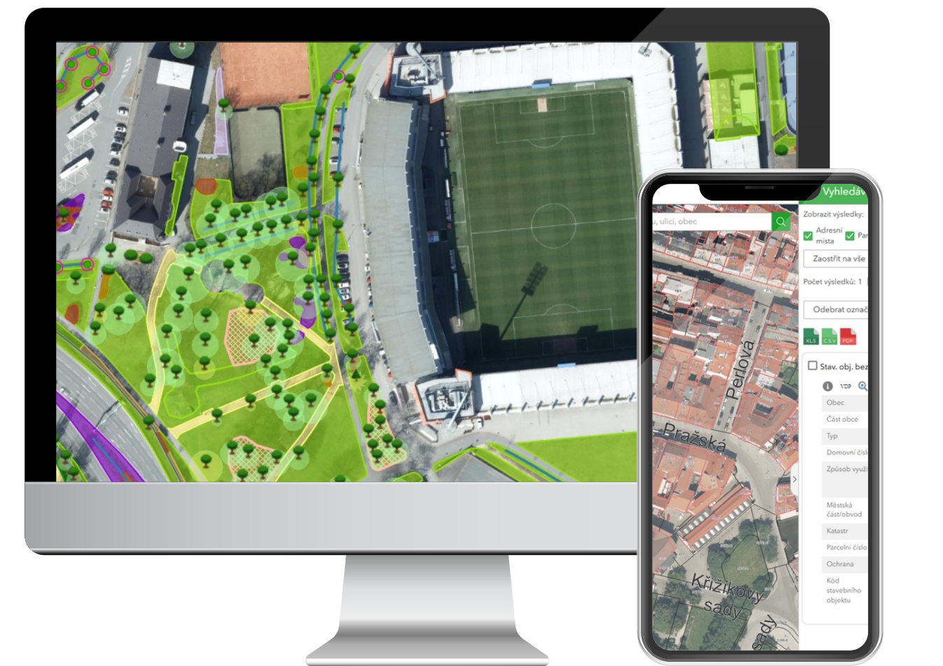
  • Green space asset register: solitary trees, tree avenues, groups of trees, groups of shrubs, solitary shrubs, hedges, grassed areas, paths, forest stands, water bodies and their surroundings. other areas, maintenance, technical and supplementary features - points, technical and supplementary features - lines, technical and supplementary features - areas, ornamental planting, ornamental areas and flower beds, technical protection of trees, contacts - manufacturers and suppliers and others.

  • Street furniture asset register: sites of playgrounds, sports grounds and rest areas, play and sports features - points, play and sports features - areas, bins and container sites, benches and tables, fences, low walls, railings, works of art, cycle racks, small architectural features, information boards, other line features, other area features, other point features, bollards, technical water features, KIOS, MIOS, maintenance, contacts - manufacturers and suppliers and others.
Digital asset management that makes sense

Key aspects

Pillars of the asset management module

Keep your assets under control. We digitise asset registers, unify data and simplify the management of infrastructure and municipal property.

Centralisation

Bring register data together with map bases in one clear system. Every structure, infrastructure element or asset is linked to an exact position on the map, to technical data, documentation and a history of changes. That gives you fast access to all the important information in the field as well as in the office.

Efficiency

Every asset register can be adapted to specific recording requirements and to the way the assets are managed. We design the data model to match the type of infrastructure, the parameters being tracked and the needs of the users. The system therefore records only the relevant information, lets you define your own attributes, relations and data categories, and can easily be extended in line with future requirements.

Security

Set detailed access control down to the level of individual structures and make sure that every user works only with the data that belongs to them.

Outputs

What you get

Using ArcGIS Enterprise from Esri, we achieve efficient map publishing and sharing of spatial data.

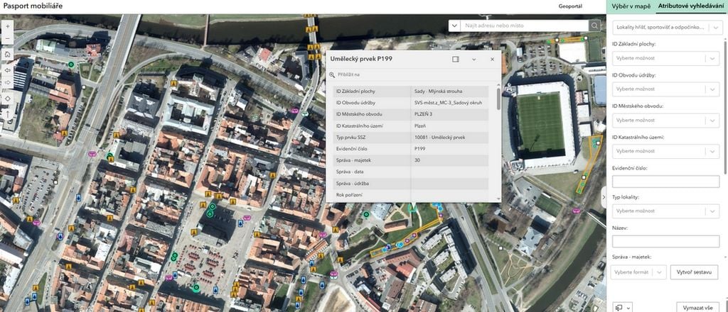
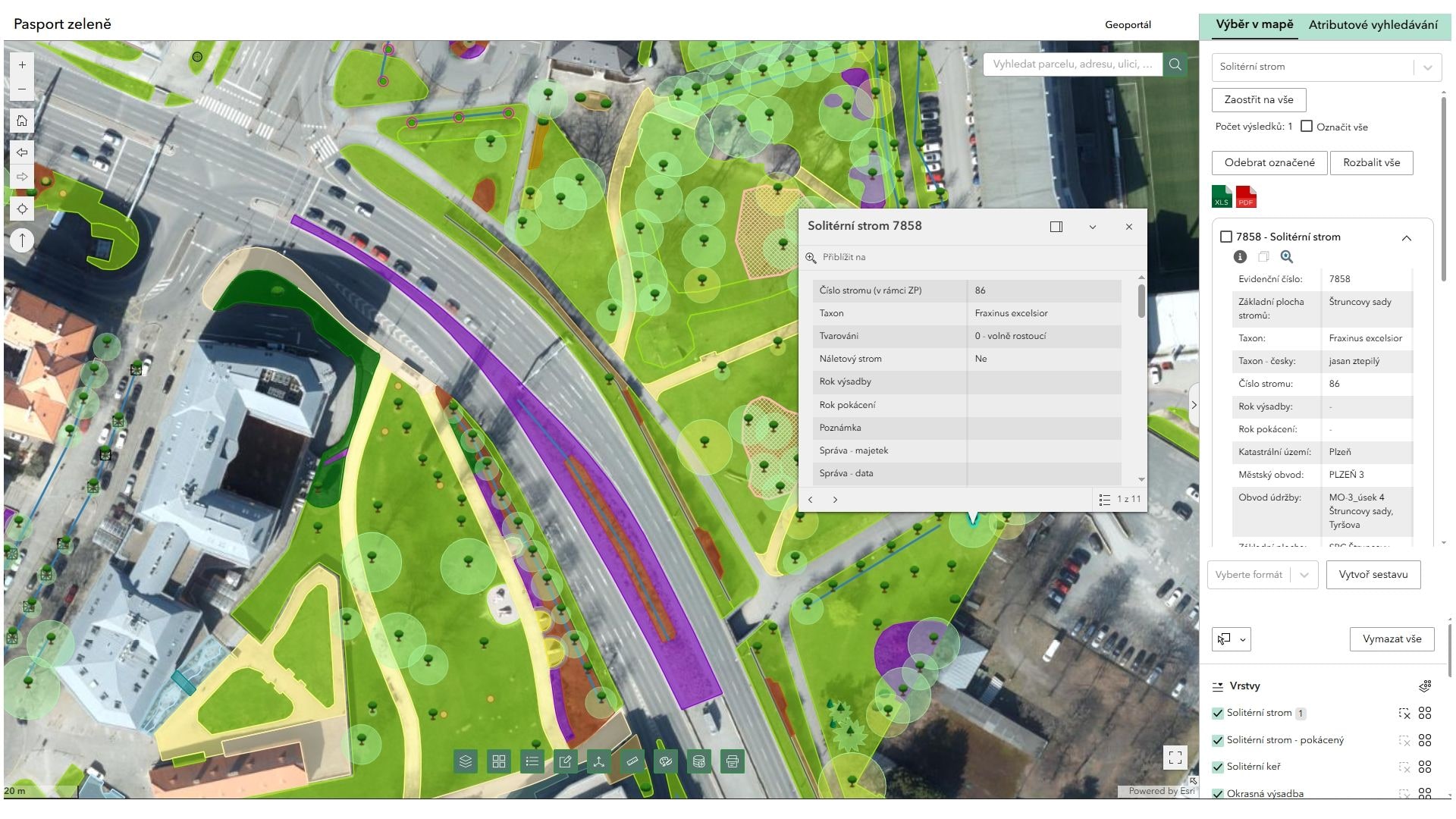
Asset register map

Register data together with map bases in one. Every structure, infrastructure element or asset is linked to an exact position on the map, to technical data, documentation and a history of changes. That gives you fast access to all the important information in the field as well as in the office. The map is fully linked to the records table.

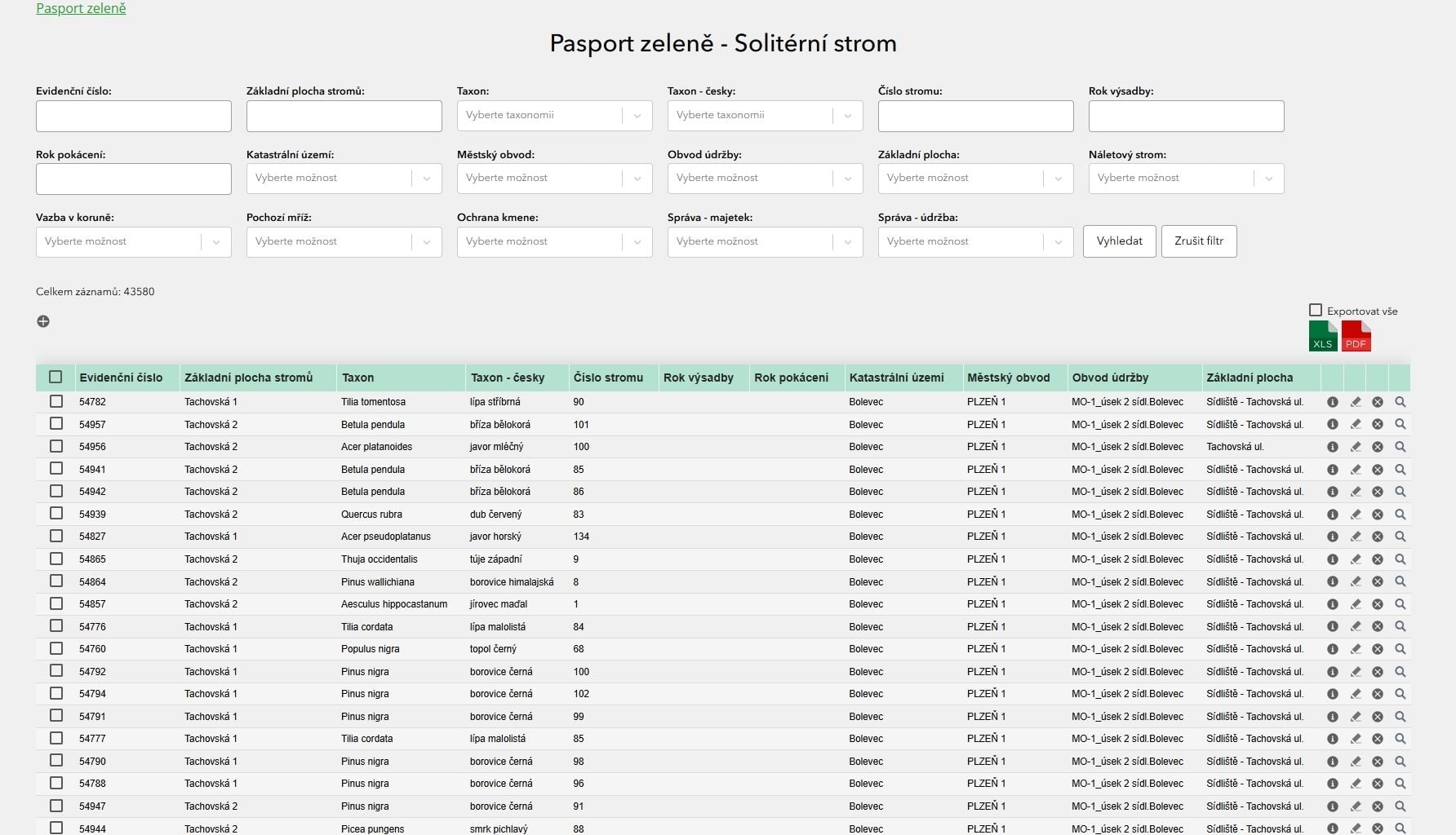
Tabular records

Register data is gathered in a single tabular overview. Every structure, infrastructure element or asset is held here as a separate record. The system includes a detail card for each element or structure, including the linked recorded elements and related information. The user can also use print reports, export data, zoom to a selected element directly on the map or edit the element.

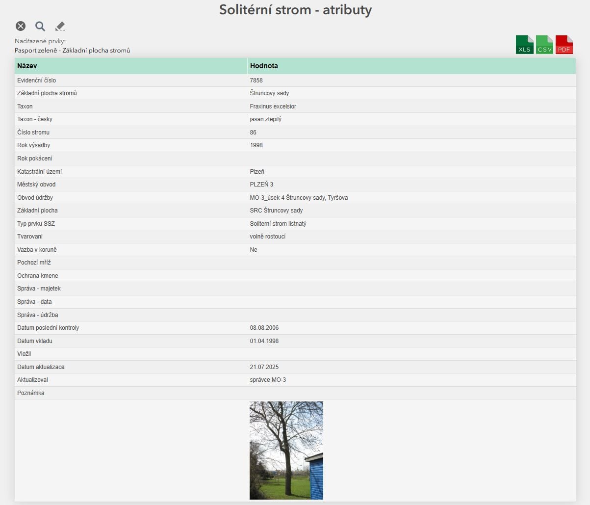
Asset register detail

The asset register detail contains complete register data on a particular structure, infrastructure element or asset, including the linked related elements and attributes. The detail also offers functions for print reports, data export and zooming to a selected element directly in the map view. The asset register can be edited. The system implements a history hierarchy that preserves the history of changes. Data can therefore be restored when needed, without any loss of the recorded information.

How it works

From brief to handover

We handle the whole asset management process, from the initial analysis to the final handover of the finished solution. First we define the scope of the project and the recording requirements together. Then comes the analysis of your data, the digitisation of the asset registers and their linking to map data. The result is a clear, working system ready for day-to-day management of property and infrastructure and for further development.

  1. 01

    Consultation and brief

    At the start we go through your requirements, the scope of the records and the goals of the project together. We propose the optimal solution for your needs.

  2. 02

    Data migration

    We convert the existing data, create the digital asset registers and prepare them for further processing in the system.

  3. 03

    Linking the data to the module

    We link the recorded data to the map bases and verify that it is correct. All the information is then clearly available to you in one place.

  4. 04

    Training and handover to operation

    We present all the functions of the system, train the users and prepare everything for a smooth go-live.

Would you like to know more?