GEOREAL spol. s r.o.

3D mesh models

Photorealistic 3D models of cities and sites created by combining nadir and oblique aerial imagery. Every facade, roof and stretch of terrain with its real texture – a baseline for spatial planning, city presentation, analyses and emergency management.

Photorealistic textureNadir + oblique imageryWhole cities and sites
3D mesh models

What it is for

A digital twin of the city

A 3D mesh is a continuous textured model of the surface – buildings, terrain, vegetation and infrastructure exactly as they look from every viewing angle.

The model is produced by automatic image correlation of aerial imagery with a high overlap: nadir imagery supplies the geometry of roofs and terrain, oblique imagery from five directions adds facades and side views. The result is a photorealistic 3D model of the whole area, in which distances, heights and areas can be measured.

Where geometric cleanliness matters more than photorealism – for calculations and simulations, for example – we produce 3D building models stereoscopically at levels of detail LoD1/LoD2 in DGN, DWG, SHP or CityGML format.

We hand mesh models over in standard formats, including tiled 3D Tiles for smooth display in web viewers – so you can open the city model in a browser without any special software.
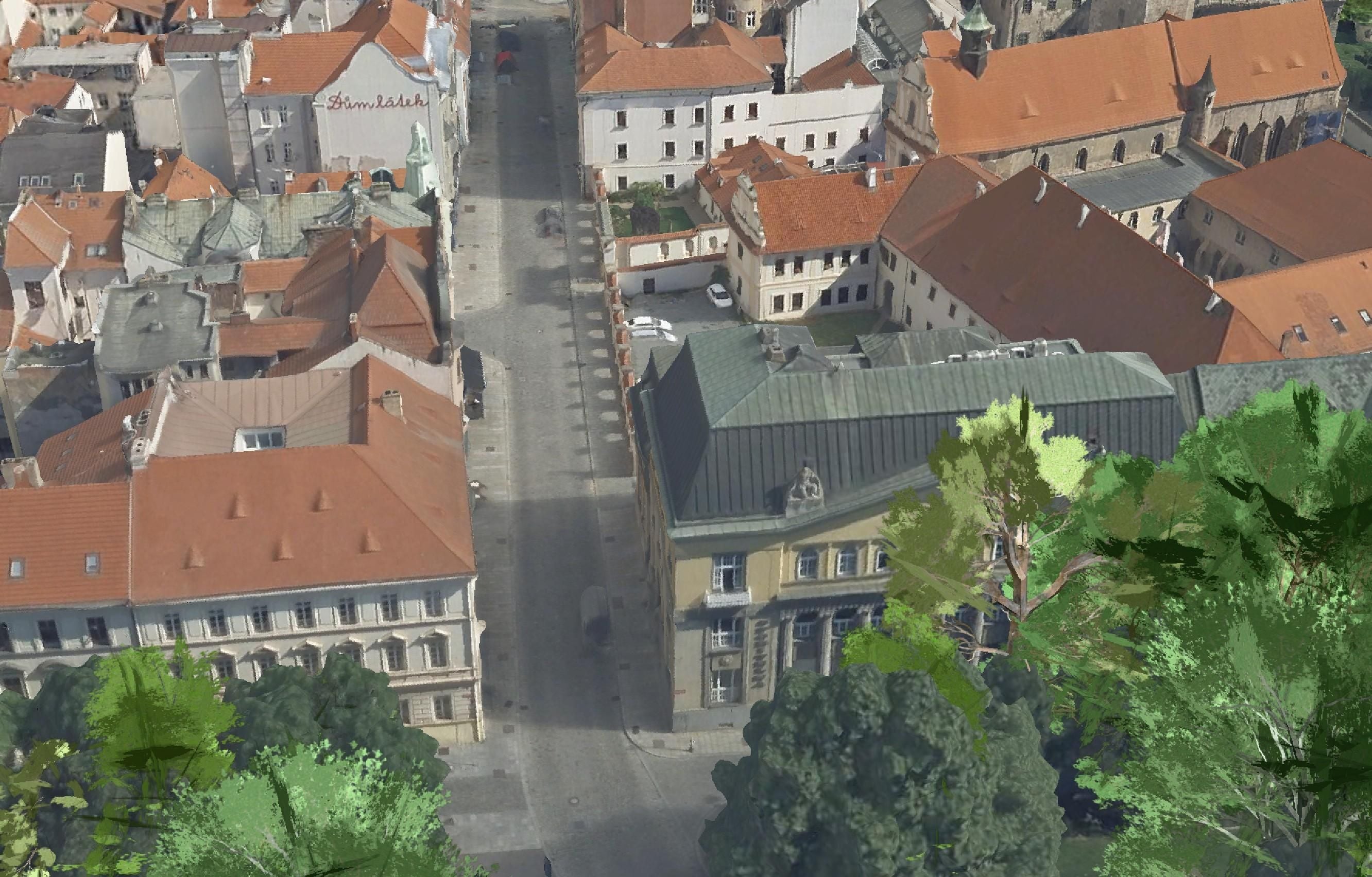
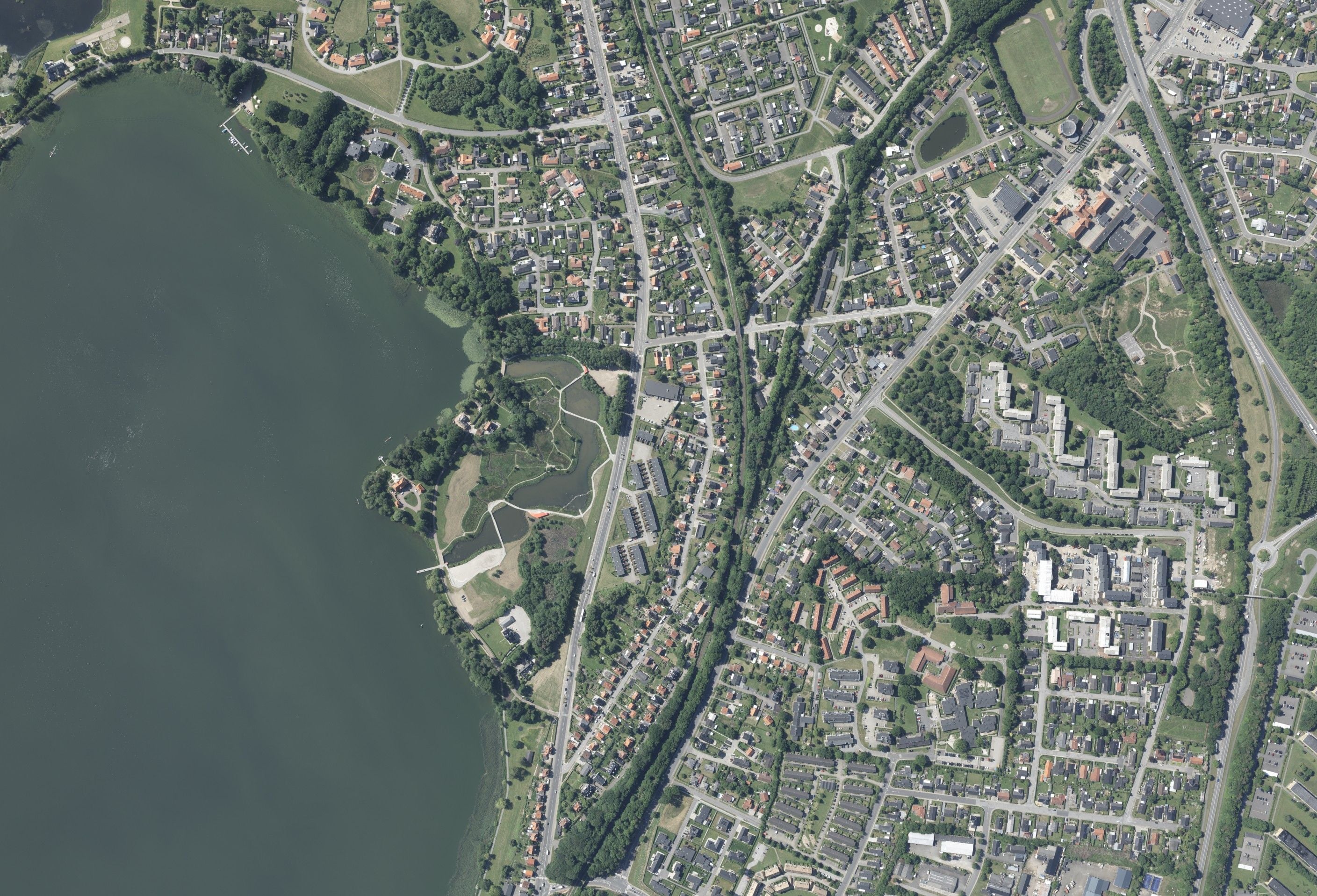
A digital twin of the city

From image to model

How a mesh model is made

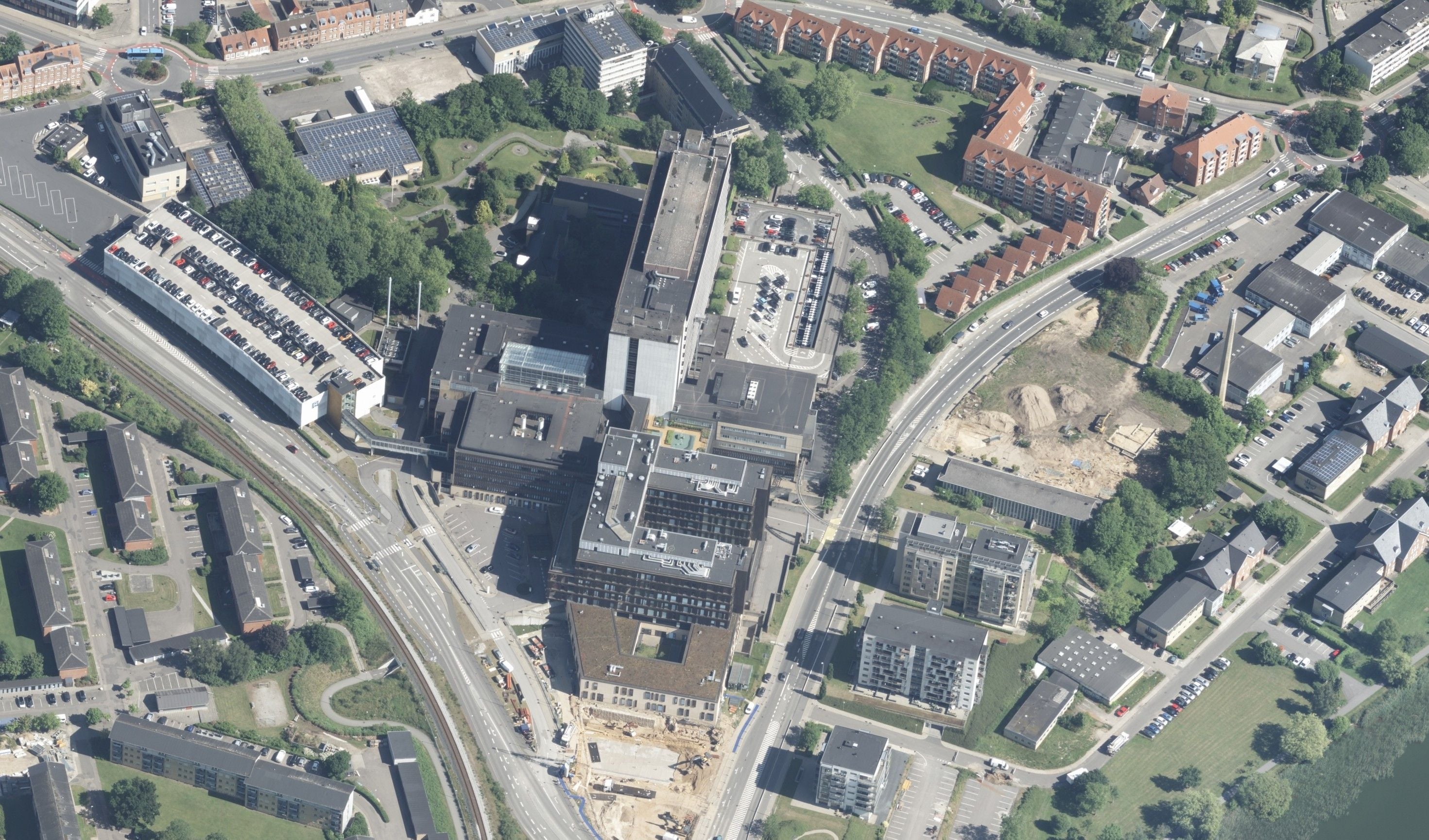
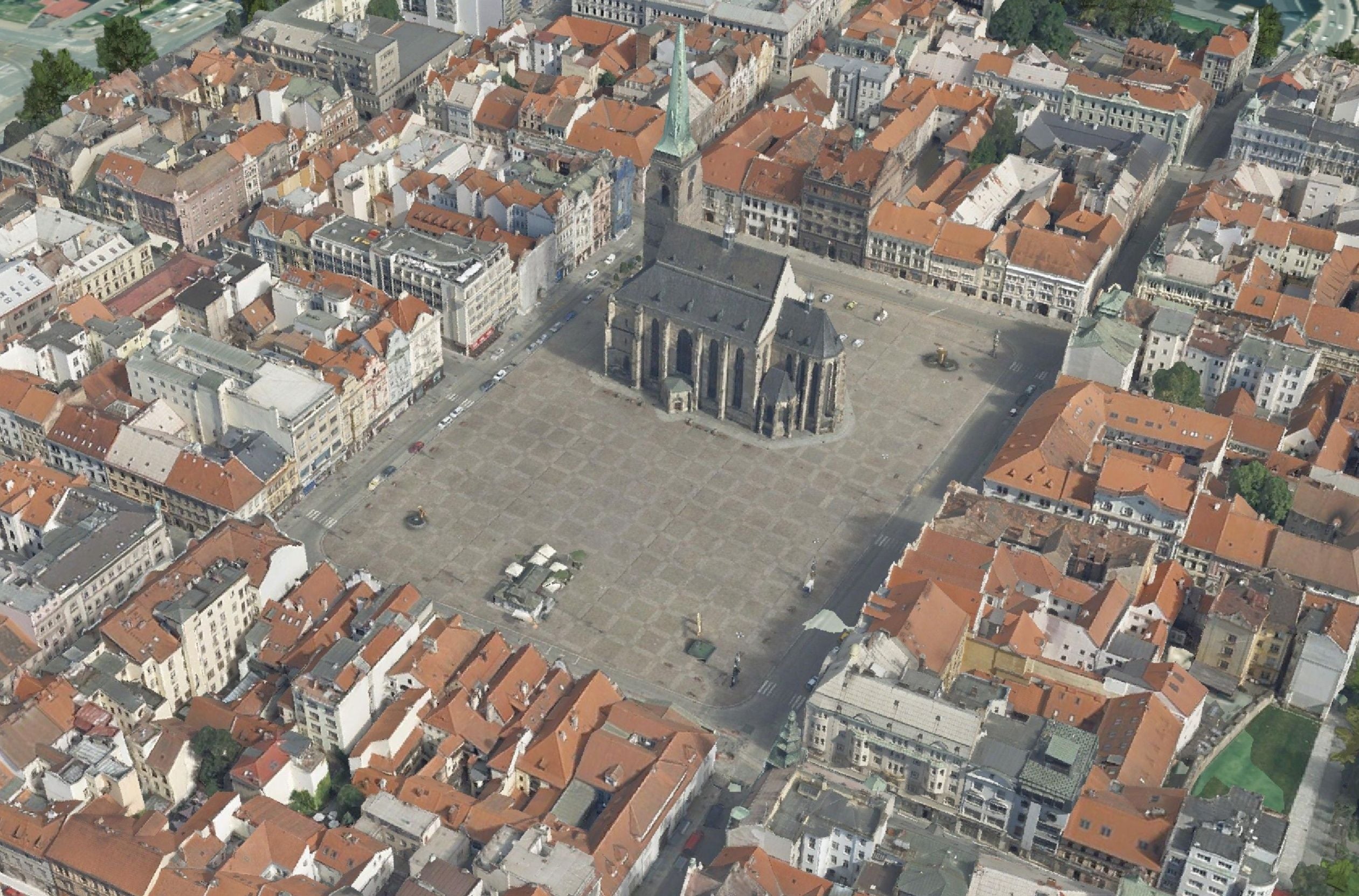
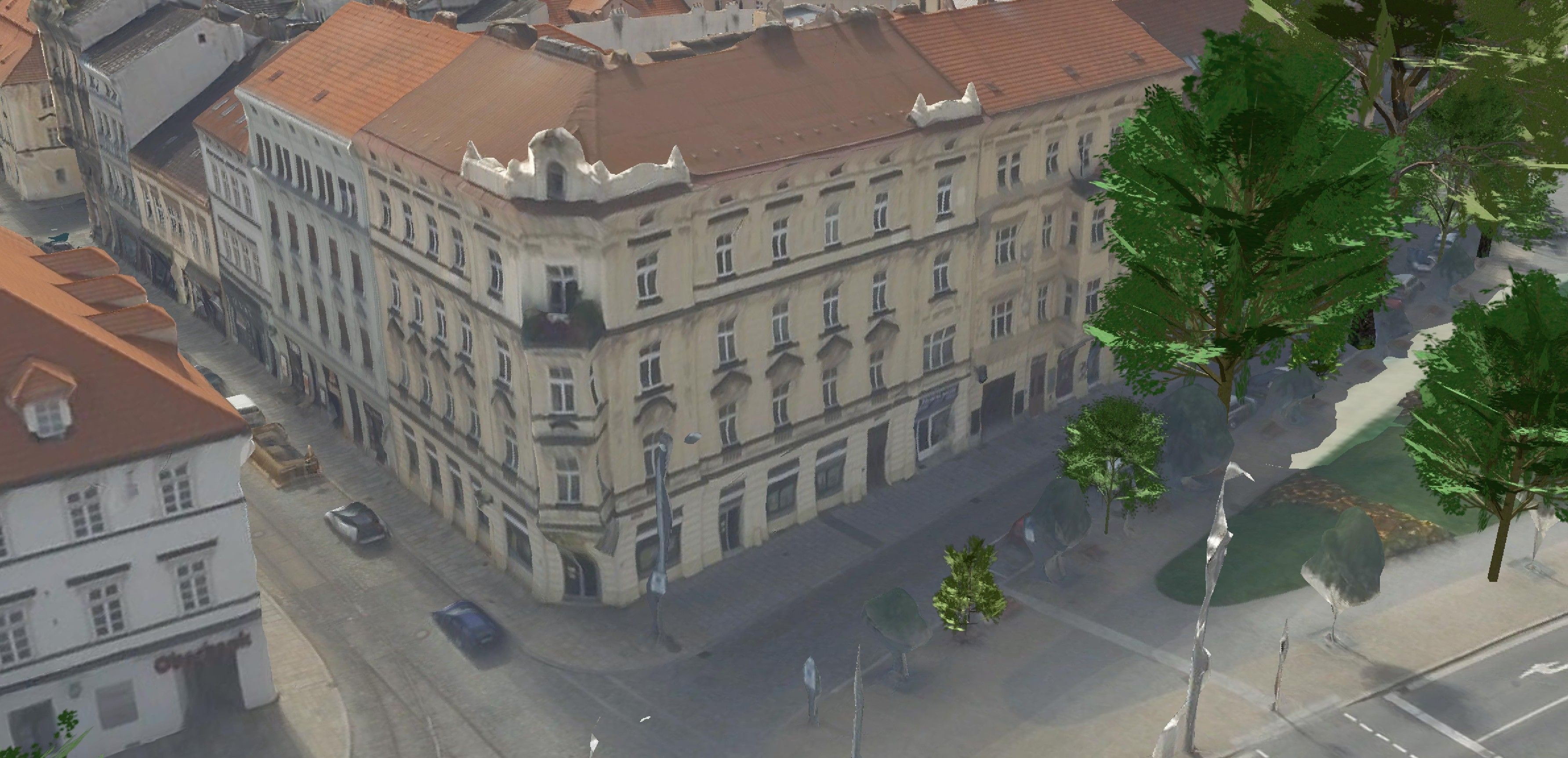
Nadir imagery gives the geometry, oblique imagery adds the facades – together they produce a photorealistic model.

Nadir image

Nadir image

A geometrically accurate view from above – the basis of the positional accuracy of the model, the roofs and the terrain.

Oblique image

Oblique image

A view at an angle adds the facades and side walls of buildings from four directions.

3D mesh model

3D mesh model

The result: a continuous textured model in which distances, heights and areas can be measured.

Typical tasks

What cities use a mesh for

  • Spatial planning and assessment of development proposals in a 3D context

  • Presentation of the city and its development projects

  • Emergency management – virtual reconnaissance before an intervention

  • Analyses of built-up areas, heights and visibility

  • A baseline for urban design competitions and studies

  • Documentation of the state of the area over time

Outputs

What you can receive

3D mesh model

A continuous textured model of the area at the chosen resolution.

OBJ / FBX / 3D Tiles

CityGML building models

Geometrically clean LoD1/LoD2 building models from stereoscopic processing.

CityGML / DGN / SHP

Web viewer

The model prepared for display in a browser, with no installation.

3D Tiles (web)

Source imagery

The nadir and oblique imagery the model was built from.

JPEG / TIFF

How it works

From the flight to the city model

  1. 01

    Brief

    We define the area, the resolution of the model and the output formats.

  2. 02

    Combined flight

    A single flight campaign captures nadir and oblique imagery at the same time.

  3. 03

    Processing

    We build the mesh by automatic image correlation and check the geometry and the textures.

  4. 04

    Handover

    We hand the model over in the agreed formats, including the web viewer.

Common questions

What you ask us most.

A mesh is a continuous photorealistic surface suitable for visualisation and measurement; a CityGML model has geometrically defined buildings with attributes – it suits analyses, simulations and connection to a GIS. Depending on the purpose we deliver one, the other, or both.

In the 3D Tiles format we make it available in a web viewer – all that is needed is a link and a common browser. For professional use we hand over OBJ/FBX into GIS, CAD and 3D tools.

It depends on the dynamics of construction – cities typically update after several years or after larger development projects. A repeat flight is cheaper than the first one, as the methodology and the ground control already exist.

Have a project where this fits?

Contact an expert

Ing. Luboš Hübsch

Ing. Luboš Hübsch

Team leader

Aerial photography and scanning