GEOREAL spol. s r.o.

Photogrammetric mapping

From aerial survey imagery we map the planimetry and altimetry of extensive areas by 3D stereoscopy. At an image resolution of 5 cm we map features at a scale of 1 : 500 to class 2–3 accuracy – faster and with more complete area coverage than ground survey can achieve.

3D stereoscopyScale up to 1 : 500Extensive areas
Photogrammetric mapping

What it is for

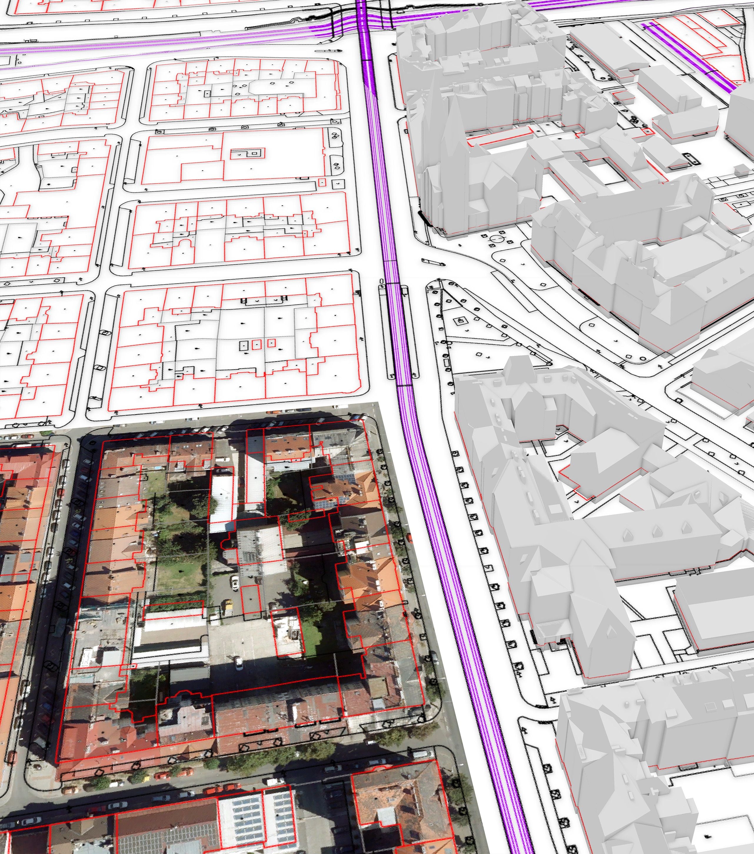
A vector map from aerial imagery

Thanks to the accuracy and the speed of data capture, photogrammetric mapping is the most suitable method for mapping extensive areas – towns, municipalities with extended powers or linear structures.

Experienced operators evaluate the aerial survey imagery at stereoscopic workstations: they see every object in 3D and vectorise the planimetry and the altimetry directly in space. The result is a special-purpose map – buildings, roads, surfaces, vegetation, terrain break lines and other features according to the agreed data model.

At a ground resolution of 5 cm we map at a scale of 1 : 500 to class 2–3 accuracy. The content and the structure of the drawing are tailored to the purpose – from base data for design work through technical maps of towns to data for GIS and Digital Technical Maps.

The input is our own aerial imagery, so the whole chain – flight, aerotriangulation, evaluation, checking – runs under one roof and we take full responsibility for the result.
A vector map from aerial imagery

Typical tasks

What photogrammetric mapping produces

  • Special-purpose maps of towns and municipalities

  • Base data for the design of linear structures

  • Data for Digital Technical Maps

  • Maps of plants and industrial sites

  • Updating of existing map works

  • Altimetry – contours and terrain break lines

Deliverables

Everything you can receive

Special-purpose map

Vector planimetry and altimetry according to the agreed data model.

DGN / DWG / SHP

Altimetry

Contours, mandatory break lines and spot heights from the 3D evaluation.

DGN / DWG / LandXML

3D vector data

Features with X, Y, Z coordinates for GIS and analyses.

SHP / GDB

Technical report

Documentation of the method, the accuracy and the imagery used.

PDF

How it works

From the flight to the map

  1. 01

    Brief and data model

    We agree the extent, the content of the drawing and the required accuracy.

  2. 02

    Flight and aerotriangulation

    We photograph the area with our own aircraft and orient the imagery precisely.

  3. 03

    Stereoscopic evaluation

    The operators vectorise the planimetry and the altimetry in 3D.

  4. 04

    Checking and handover

    We check the drawing in the field and topologically and hand it over in your format.

Common questions

What you ask us most.

For extensive areas – from a few km² upwards – aerial mapping is considerably faster and cheaper and the result is consistent across the whole area. Ground survey is added where more detail is needed or where features are hidden from the air.

At an image resolution of 5 cm we map features at a scale of 1 : 500 to class 2–3 accuracy. For more demanding requirements we choose a finer ground sample distance (GSD) or a combination with ground survey.

Under dense vegetation the imagery does not capture the ground – there we combine photogrammetry with airborne laser scanning (LiDAR), which penetrates the vegetation.

Have a project where this fits?

Contact an expert

Ing. Luboš Hübsch

Ing. Luboš Hübsch

Team leader

Aerial photography and scanning