


Surveying routes and structures
Classic surveying of valves, manholes and access points, as well as large-scale capture in the streets by mobile mapping.
Out-of-date documentation, inaccurate asset records, no consistent way of recording utility networks. Utility locating and surveying, asset management, data for the regional Digital Technical Maps (DTM), 3D scanning and mobile mapping – a complete solution for utility networks from a single supplier.
Does this sound familiar?
We want an accurate overview of our infrastructure and data we can rely on.
Data on networks, structures and assets sits in different systems, different formats and often in different places.
We need to know exactly where the infrastructure runs and what condition it is in – including where it cannot be seen with the naked eye.
We want to hand our network data over to the DTM quickly and easily, and keep an overview of it.
We need to share data easily between colleagues, contractors and other parties without lengthy searching and format conversion.
Why Georeal
We survey the data in the field and we build the software you will work with. No handovers between subcontractors.
Aerial photography, scanners, surveyors in the field. We are equipped for all of it.
We build geoportals, mobile applications and extensions for the software you are used to working in.
We cover every service across the field of surveying.
Surveying the networks
Documentation is often older than the last reconstruction, and in the field it is the excavator that finds out. We survey the routes and the structures on them and hand them over in coordinates you can work with – not as a scan of a paper drawing.
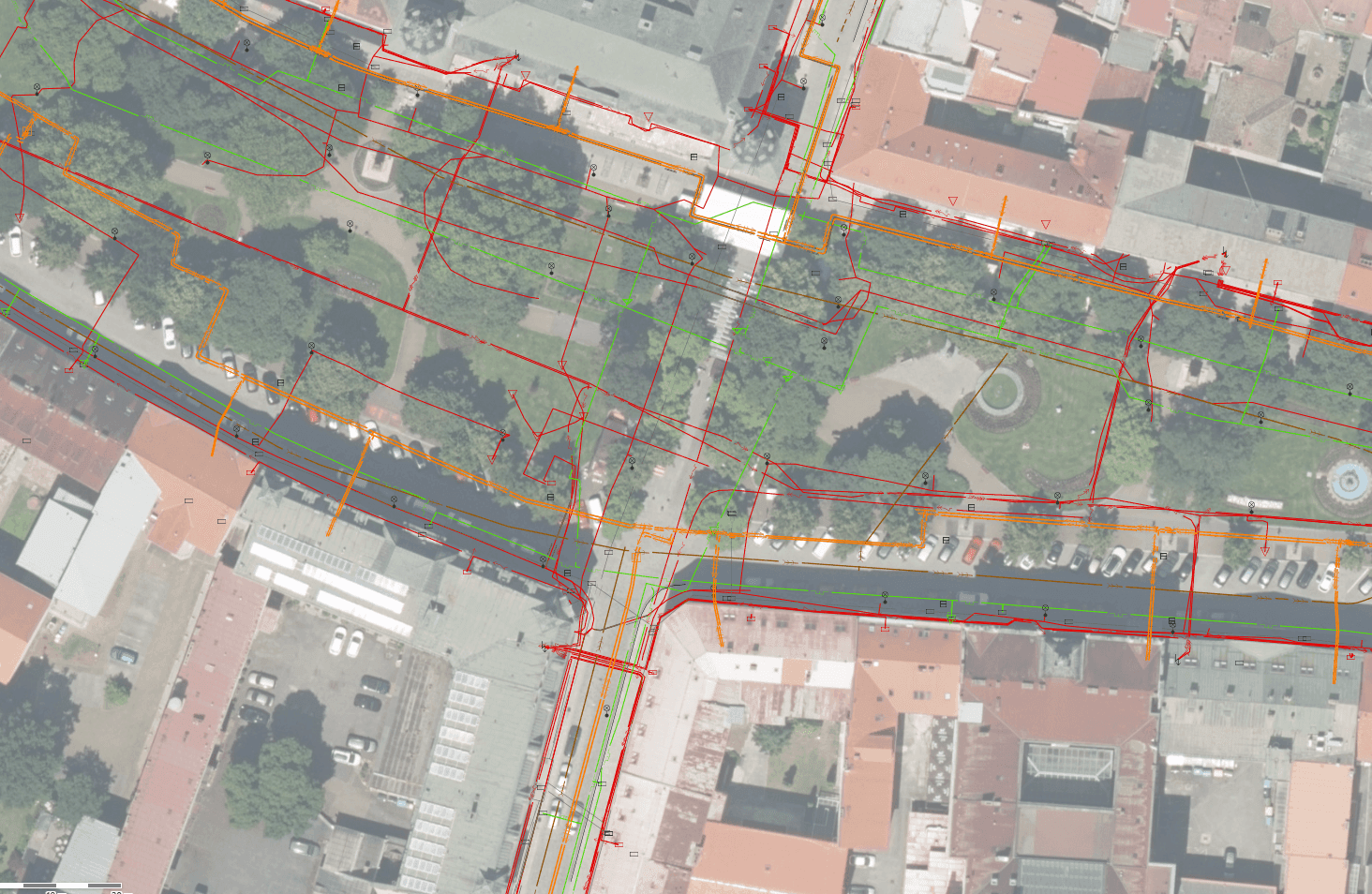
Classic surveying of valves, manholes and access points, as well as large-scale capture in the streets by mobile mapping.

Pumping stations, substations, chambers and utility tunnels in 3D – a point cloud and a model you can take measurements from.

After every construction job there is a record of what actually lies where – including setting out before the work starts.
A single set of records
A spreadsheet, a drawing and a map drift apart within a year. We unify the records over a map, link ownership relations from the cadastre to them and open them to people in the field as well.
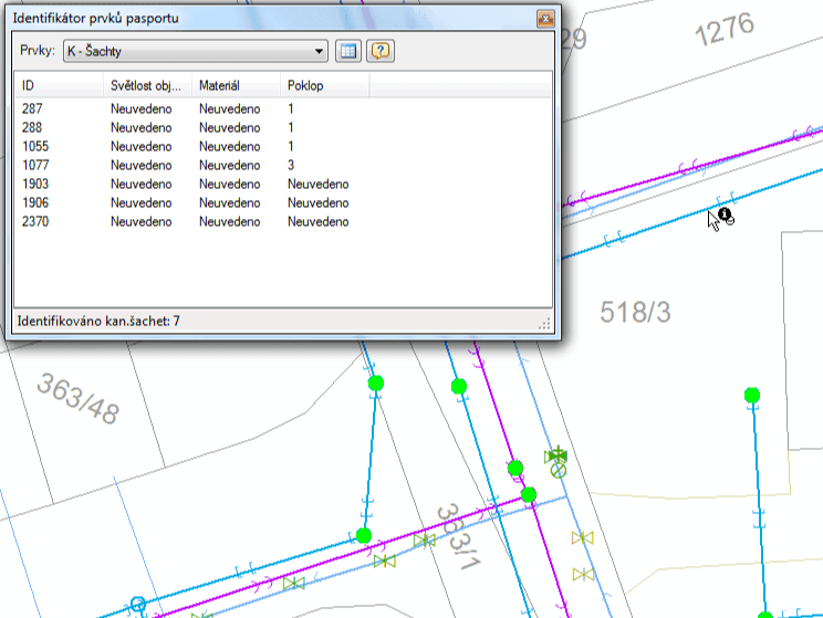

Every item has its own record with attributes, condition and history – from the office and from a mobile in the field.

Who owns the land above a pipeline you find out by clicking in the map, not by requesting an extract.

You do not have to change your environment. Extensions for ArcGIS and QGIS, plus one-off conversions and data checks.
The DTM agenda
As a network operator you are the editor of your data in the DTM. We prepare it into the structure the region accepts, check it before submission and send changes continuously, not once a year.
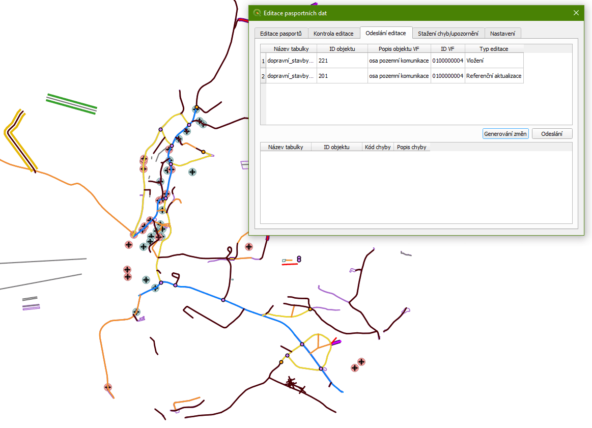

Conversion from your formats into the technical map data model, including checks before submission.

Surveying the blank spots in the network where documentation is missing entirely.
Where your data ends up
Keeping documentation current
Jobs that come up with every reconstruction and every new connection point.

Recording the network in the cadastre in order to establish an easement.

Setting out the route and the boundaries in the field, so that digging happens where it should.
How it works
Three steps that repeat over and over with utility networks.
An open trench is surveyed before it is filled in – after that there is only guesswork. Structures on the network we survey in the classic way or with a scanner.
The survey becomes an entry in the records and updated documentation – not a folder of drawings nobody can navigate a year later.
The change is checked and submitted to the regional technical map. Error reports coming back are handled by us, not by you.
Common questions from this industry
If you cannot find the answer to your question, do not hesitate to contact us.
Yes. We are involved in the DTM solutions of 12 regions in the Czech Republic, so we know exactly in what structure and with what checks data enters the technical map.
No. Besides our own applications we build extensions for both ArcGIS and QGIS, so the tools are added to the environment your people already know.
Yes, locating and surveying routes is a routine part of our work. The scope and the procedure are always agreed according to the type of network and the environment.
Not sure where to start?
Tell us what you have documented and what you do not. From that we propose where to start – it is usually not the whole network at once.