GEOREAL spol. s r.o.

DSM / DTM models

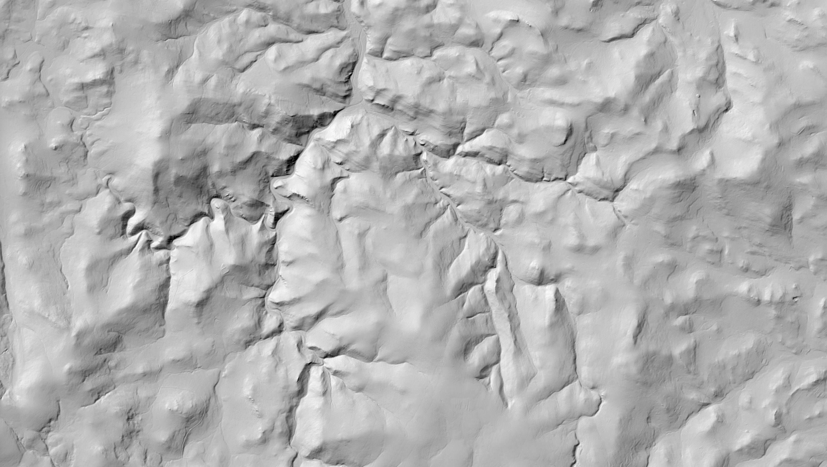
A digital terrain model (DTM) captures the surface of the Earth without structures and vegetation; a digital surface model (DSM) includes them. We create them by 3D stereoscopy from aerial imagery or from LiDAR point clouds – in a form your software reads directly.

Terrain and surfaceStereoscopy or LiDARTIN · GRID · contours
DSM / DTM models

What it is for

The elevation basis of every spatial task

Design work, hydrology, planning and 3D visualisation all depend on a faithful terrain model. And the difference between a DTM and a DSM decides what the model is good for.

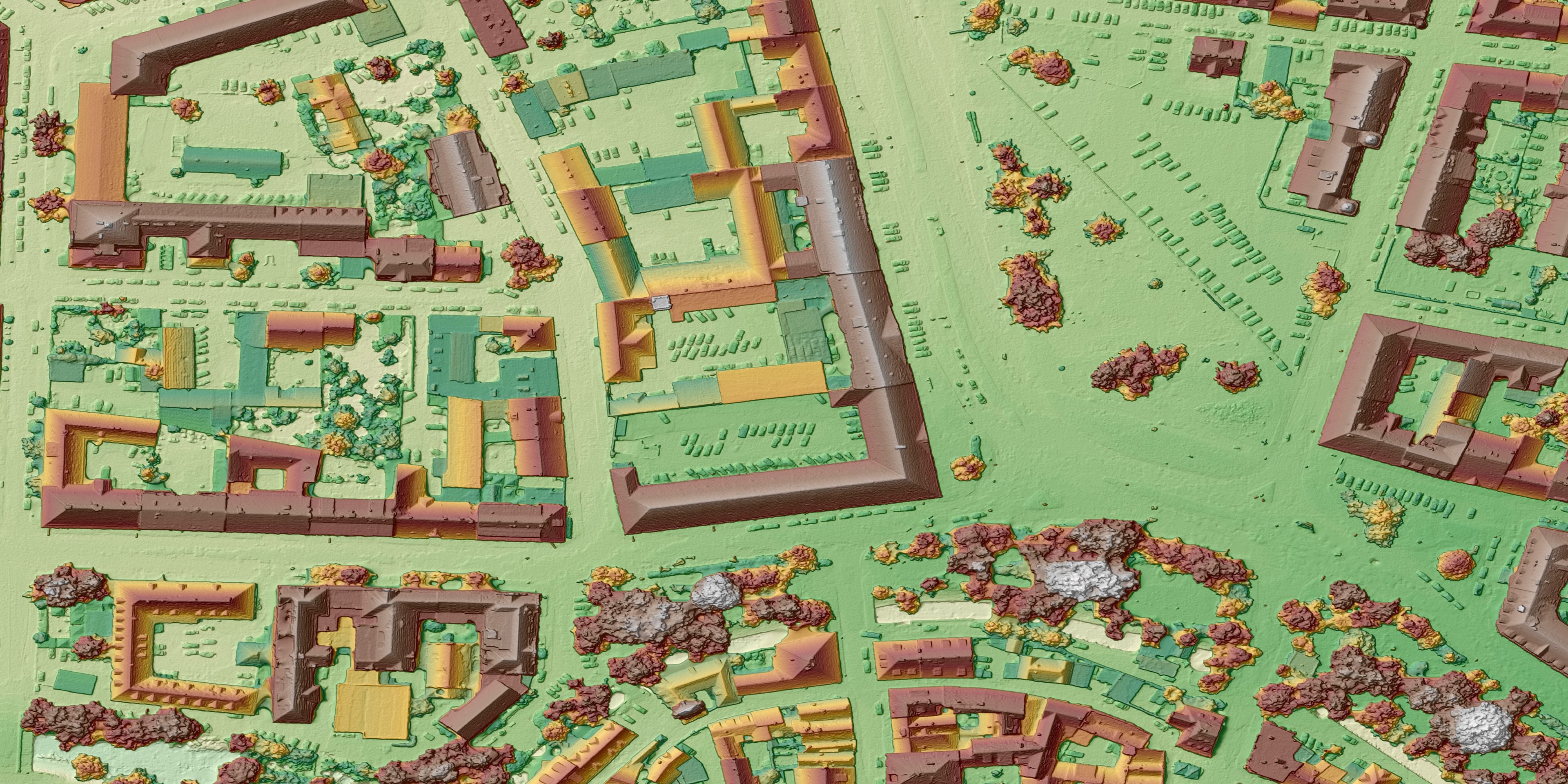
A digital terrain model (DTM) is a model of the surface of the Earth without structures, trees and other objects – the “bare earth” for design work, runoff analyses and volume calculations. A digital surface model (DSM) shows the surface including vegetation and buildings – an input for visibility analyses, telecommunications or the solar potential of roofs.

We create the models by 3D stereoscopy from aerial survey imagery or by deriving them from a classified LiDAR point cloud; the method is chosen according to the area and the required accuracy. We check quality on control areas and terrain break lines – it is precisely the mandatory break lines that distinguish a good model from an average one.

We deliver the output in the representation your software reads directly: contours, mandatory break lines, spot heights, triangulated networks (TIN), regular rasters (GRID), point clouds and MESH.
The elevation basis of every spatial task

Typical tasks

What the models are used for

  • Base data for design and earthworks

  • Hydrological and runoff analyses

  • Volume calculations and material balances

  • Visibility and built-up area analyses

  • Production of orthophotos and true orthophotos

  • 3D visualisation and simulation

Deliverables

What you can receive

DTM – terrain model

The surface without structures and vegetation for design and analyses.

TIN / GRID / GeoTIFF

DSM – surface model

The surface including buildings and vegetation.

TIN / GRID / GeoTIFF

Contours and break lines

Derived altimetry including mandatory break lines.

DGN / DWG / SHP

Point cloud

The source elevation data for your own processing.

LAS / LAZ / XYZ

How it works

From brief to model

  1. 01

    Brief

    We clarify the purpose, the accuracy and the required representation of the model.

  2. 02

    Data acquisition

    We fly imagery or LiDAR; at smaller sites we use a drone.

  3. 03

    Model production

    We evaluate the altimetry, add break lines and check the model.

  4. 04

    Handover

    We hand over the model in the formats used in your environment.

Common questions

What you ask us most.

For design, volumes and hydrology a DTM (the “bare terrain”); for visibility, telecommunications or solar analyses a DSM (with buildings and vegetation). We can deliver both from a single flight.

It depends on the method and the density of the data – vertical accuracy ranges from a few centimetres (LiDAR, fine GSD) to decimetres for overview models. We specify the accuracy in advance and verify it on control areas.

Yes – we supply standard representations (TIN, GRID, LandXML, GeoTIFF, LAS) for CAD, GIS and design systems such as Civil 3D. The format is agreed when the work is commissioned.

Have a project where this fits?

Contact an expert

Ing. Luboš Hübsch

Ing. Luboš Hübsch

Team leader

Aerial photography and scanning
DSM / DTM models | GEOREAL