

Which datasets does the RÚIAN module display?
- RÚIAN: address points, land parcels, streets and building objects.
Fast, clear access to data from the RÚIAN register (Register of Territorial Identification, Addresses and Real Estate) through a modern web application. Map data linked with register records lets you work easily with information on the area, addresses, buildings and land parcels in one intuitive interface.
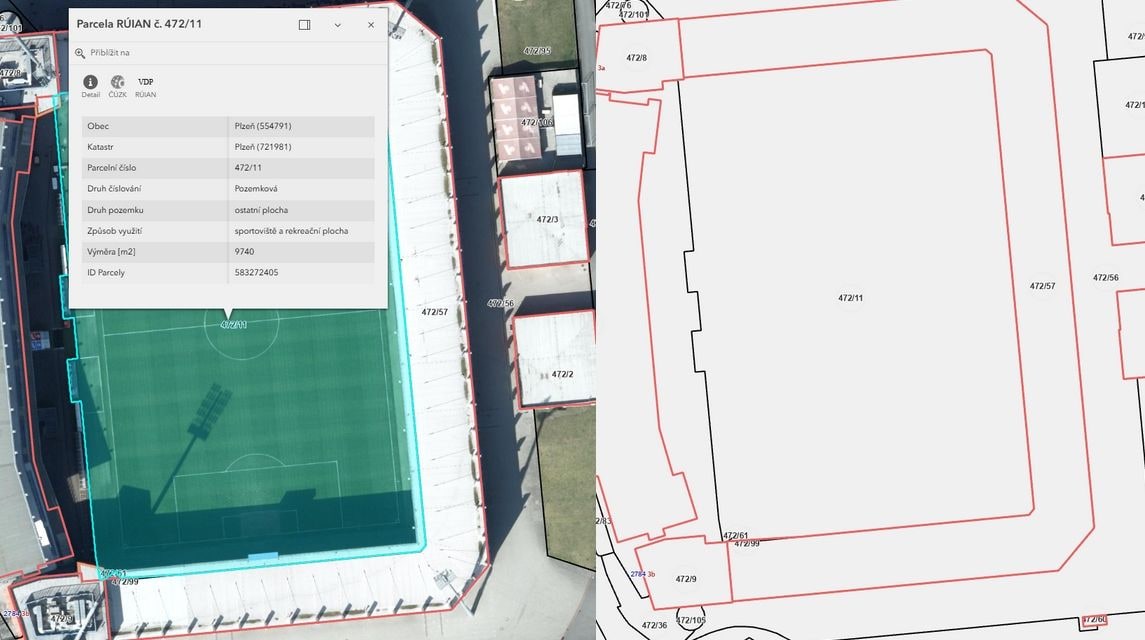
What it is for
A modern web application for quickly viewing and working with data from the RÚIAN register. It links map data and register records clearly, so all the important information on the area, addresses, buildings and land parcels is in one place.
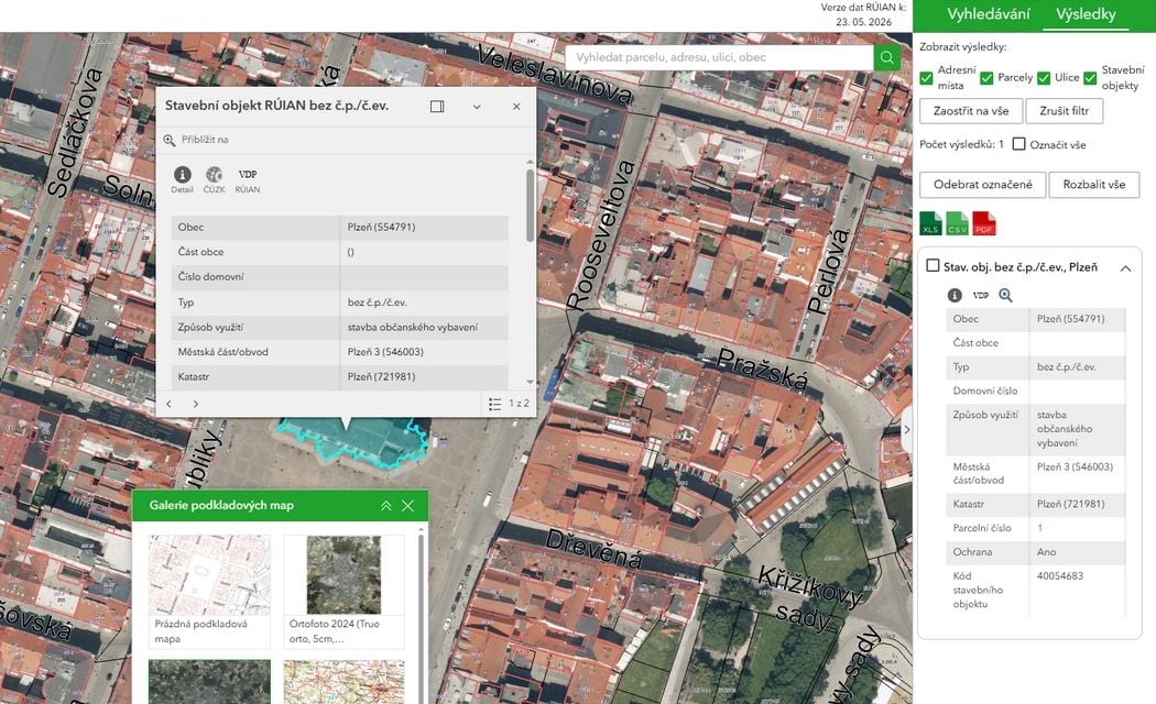
Key aspects

The application brings territorial elements, address points, land parcels, buildings and other related information together in one system. That gives you a quick and complete overview of the relationships between individual objects.

Search, filter and export data from the RÚIAN register according to your needs. The data is available both in the map and in clearly arranged tables for easy orientation.

For every record you can immediately display detailed information, including identifiers, territorial relationships and related objects, without having to search in other registers.
Deliverables
With ArcGIS Enterprise from Esri we achieve efficient map publishing and spatial data sharing.
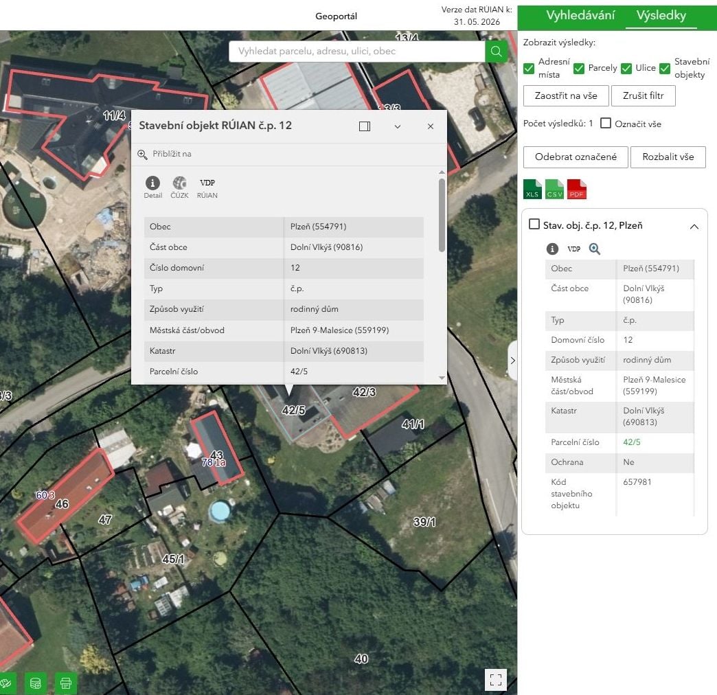
An interactive map with current RÚIAN data that allows easy orientation in the area and quick searching for related information. The map can display address points, building objects, land parcels, streets, cadastral districts and other elements of the RÚIAN register, including their mutual relationships and detailed data.
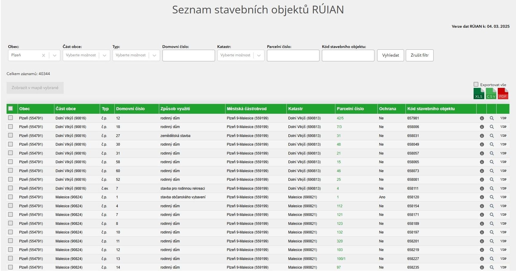
All information from the RÚIAN register is available in a clearly arranged table view. Every element – an address point, building object, land parcel, street or territorial unit – is kept as a separate record with a clear structure and links to related data. Users can make use of advanced functions such as filtering, data export, print reports or showing the selected element directly in the map.
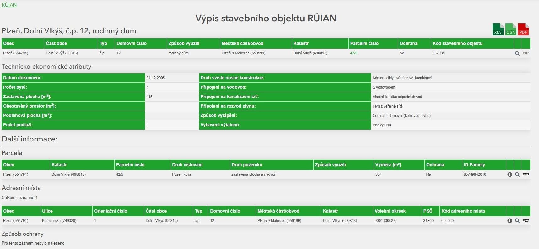
The system includes a detail card for every RÚIAN element, showing all the key information including identifiers, descriptive data and links to related address points, building objects, land parcels or territorial elements. The clear layout gives you quick access to all the important information in one place.
How it works
We handle the whole process from the initial analysis to the final handover of the finished solution. First we define the requirements for the records together. Then we import the data and link it with the map data. The result is a clear, working system ready for day-to-day administration or for further development according to your needs.
At the start we go through your needs, the scope of the records and the goals of the project together. We propose the best way to deploy the system.
We carry out a complete import of data from the available sources and prepare it for further processing.
We take care of the complete build-up of the RÚIAN data and of linking it to the map layers. During the work we pay attention to accuracy, clarity and data compatibility, so that the system is easy to administer and to extend further.
We present all the functions of the system, train the users and prepare everything for a smooth start of live operation.