GEOREAL spol. s r.o.

Mine surveying documentation

For mining organisations we compile, update and maintain complete mine surveying documentation in digital form in line with Decree No. 435/1992 Coll. – from basic mine maps and maps of surfaces and of the works, through further special-purpose maps and sections and the required records, to baseline data for mine design and for dealings with the public administration. Responsibility is carried by chief mine surveyors holding a valid authorisation.

Decree No. 435/1992 Coll.Chief mine surveyorMaps of the worksDigital and print outputs
Mine surveying documentation

What it is for

Documentation that mining cannot do without

Every organisation carrying out mining activities, or activities performed using mining techniques, must keep mine surveying documentation. We keep it for you – professionally, continuously and in line with the legislation.

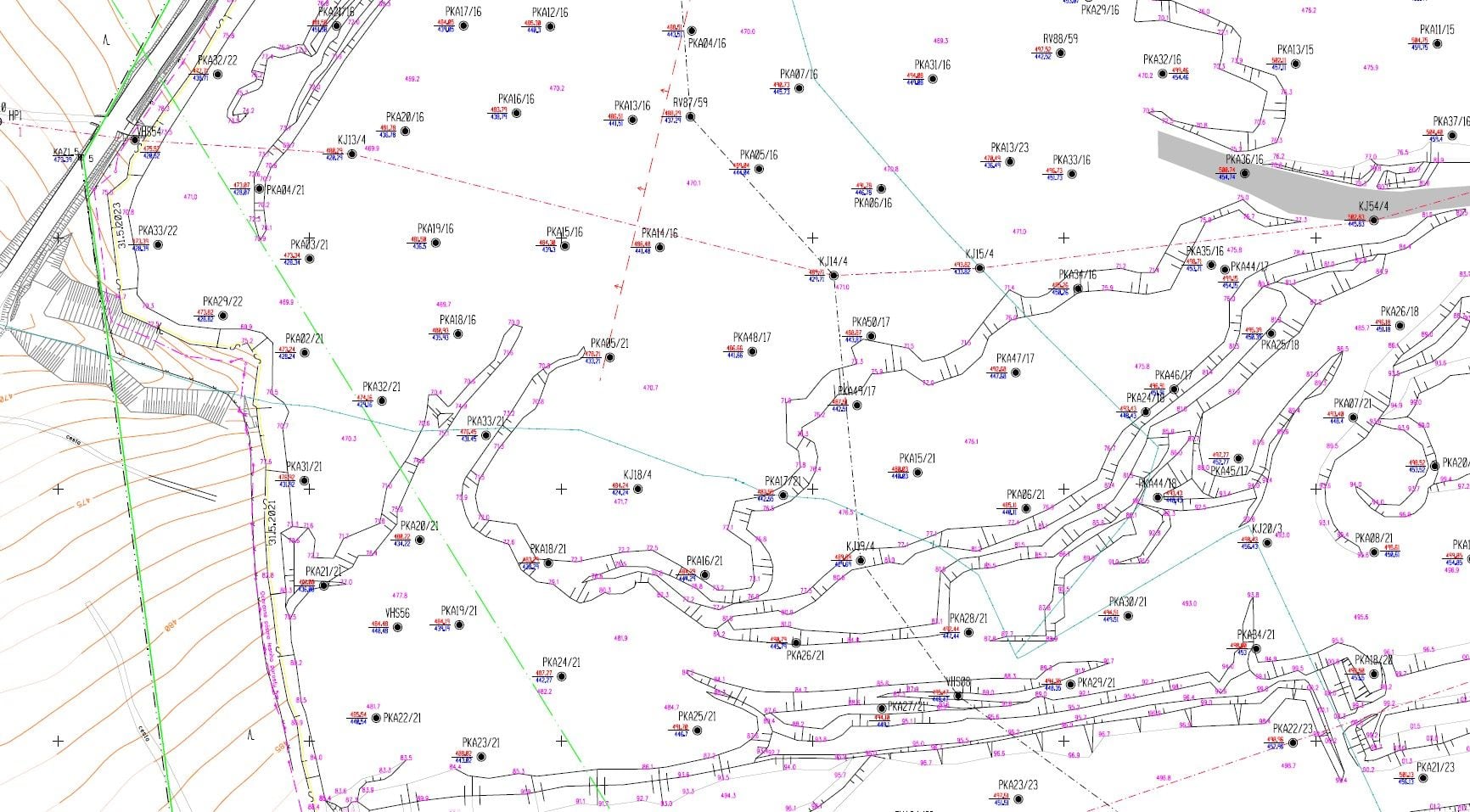
Mine surveying documentation is a set of maps, sections and records that captures the state and the progress of extraction. Its core is the basic mine map – a map compiled under uniform technical regulations that shows in detail the structures and technical installations on the surface, below it and above it.

We provide the complete service: compilation and continuous updating of the basic map documentation, special-purpose survey work, production of sections and profiles, and print and digital outputs for operational, planning and record-keeping activities, including baseline data for emergency plans in the field of occupational health and safety and fire protection.

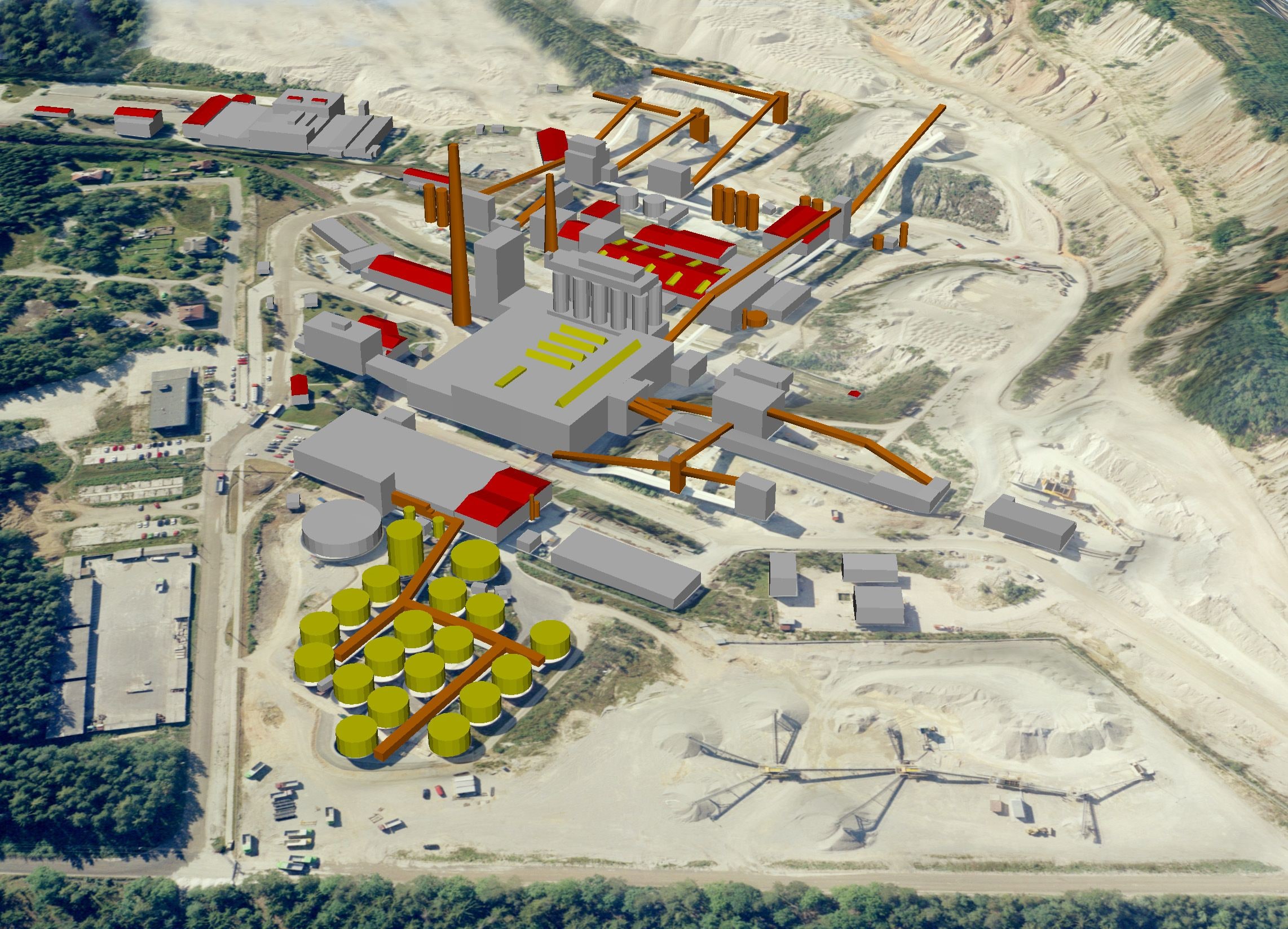
We survey the state of the quarry with current technology – terrestrial laser scanning, aerial photogrammetry and drones (unmanned aerial vehicles, UAVs). The result is accurate 3D baseline data from which we build, besides the maps, spatial analyses and visualisations of the area. We can also hand the data over into a mine GIS.
Documentation that mining cannot do without

What it covers

Complete mine surveying service

  • Compilation and updating of basic mine maps and maps of the works

  • Special-purpose survey work and special-purpose maps

  • Print and digital outputs

  • Photographic documentation of geological profiles and structures

  • Baseline data for mine and building design

  • Baseline data for specialised documentation such as EIA

  • 3D spatial analyses and visualisations of the area

  • Consultancy in surveying and the Cadastre of Real Estate

Outputs

What you can receive

Basic mine map and map of the works

Compilation of a new map and continuous updating of an existing one following the progress of extraction.

DGN / DWG / PDF / print

Special-purpose maps and sections

Profiles, sections and thematic maps for operations, planning and dealings with the authorities.

DGN / DWG / PDF

3D model of the quarry

An up-to-date surface model of the quarry from laser scanning or photogrammetry.

point cloud / TIN

Photographic documentation of profiles

Georeferenced imagery of geological profiles and structures.

JPEG / TIFF

Baseline data for design

Survey baseline data for mine and building projects and for EIA documentation.

DWG / SHP / as specified

How it works

From taking over the documentation to regular updates

  1. 01

    Consultation and handover

    We go through the existing documentation, the extent of the mining area and the requirements of the mining authority.

  2. 02

    Survey on site

    We survey the state of the quarry by laser scanning, photogrammetry, drone or conventional surveying, depending on the character of the site.

  3. 03

    Processing

    We update the maps, sections and records; the results are verified by a mine surveyor.

  4. 04

    Handover and update cycle

    We hand the documentation over digitally and in print and agree the interval of regular updates.

Common questions

What you ask us most.

Responsibility for keeping the documentation is carried by a chief mine surveyor holding a certificate of professional competence. Our staff hold authorisations both as chief mine surveyor and as mine surveyor – we therefore keep the documentation in full, including the responsibility.

According to the progress of extraction and the requirements of Decree No. 435/1992 Coll. We set the interval according to the intensity of extraction in your operation – from continuous updating to annual cycles.

As standard in digital form (DGN, DWG, PDF, GIS layers, point clouds) and as print outputs. We adapt the format to your environment and to the requirements of the State Mining Administration.

Have a project where this fits?

Contact an expert

Ing. Tomáš Vybíral, Ph.D.

Ing. Tomáš Vybíral, Ph.D.

Team leader

3D scanning and mine surveying
Mine surveying documentation | GEOREAL