GEOREAL spol. s r.o.

Setting out land parcel boundaries

Not sure exactly where the boundary of your land runs? We set it out on the ground from the records of the Cadastre of Real Estate, mark the turning points with boundary markers and demonstrably inform both you and the owners of the neighbouring parcels of the course of the boundary.

Based on cadastral recordsMarked with boundary markersSetting-out report
Setting out land parcel boundaries

What it is for

The boundary from the map back onto the ground

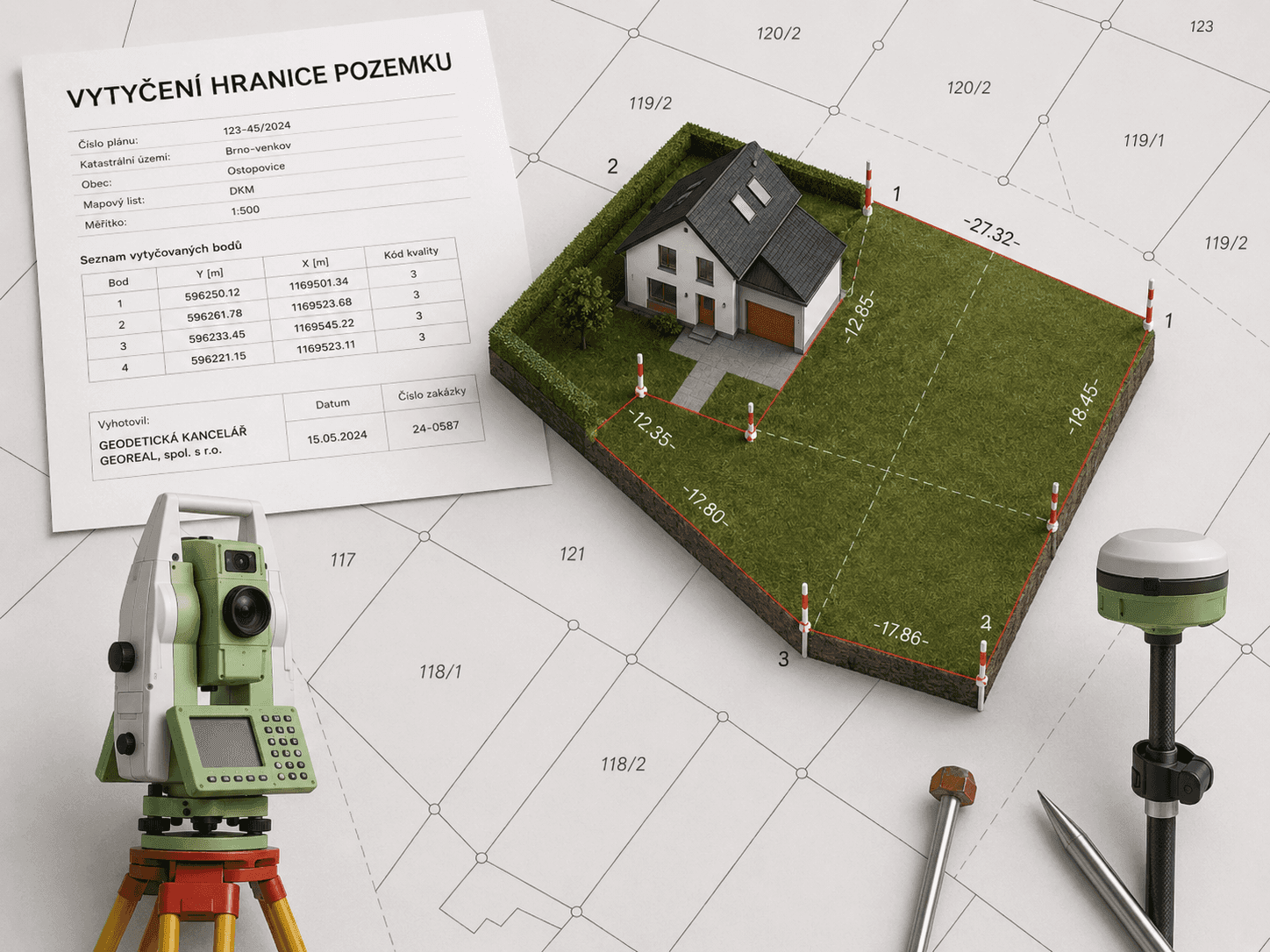
Setting out a boundary is a surveying activity in which the positions of the turning points of a land parcel boundary are marked on the ground according to the records of the Cadastre of Real Estate.

Setting out is worth doing before you build a fence, plant, sell a parcel, or when there is a dispute with a neighbour over where the boundary runs. We work from the geometric and positional determination of the parcels in the cadastre – the accuracy of the setting out therefore corresponds to the quality of the available cadastral records, which we explain to you in advance.

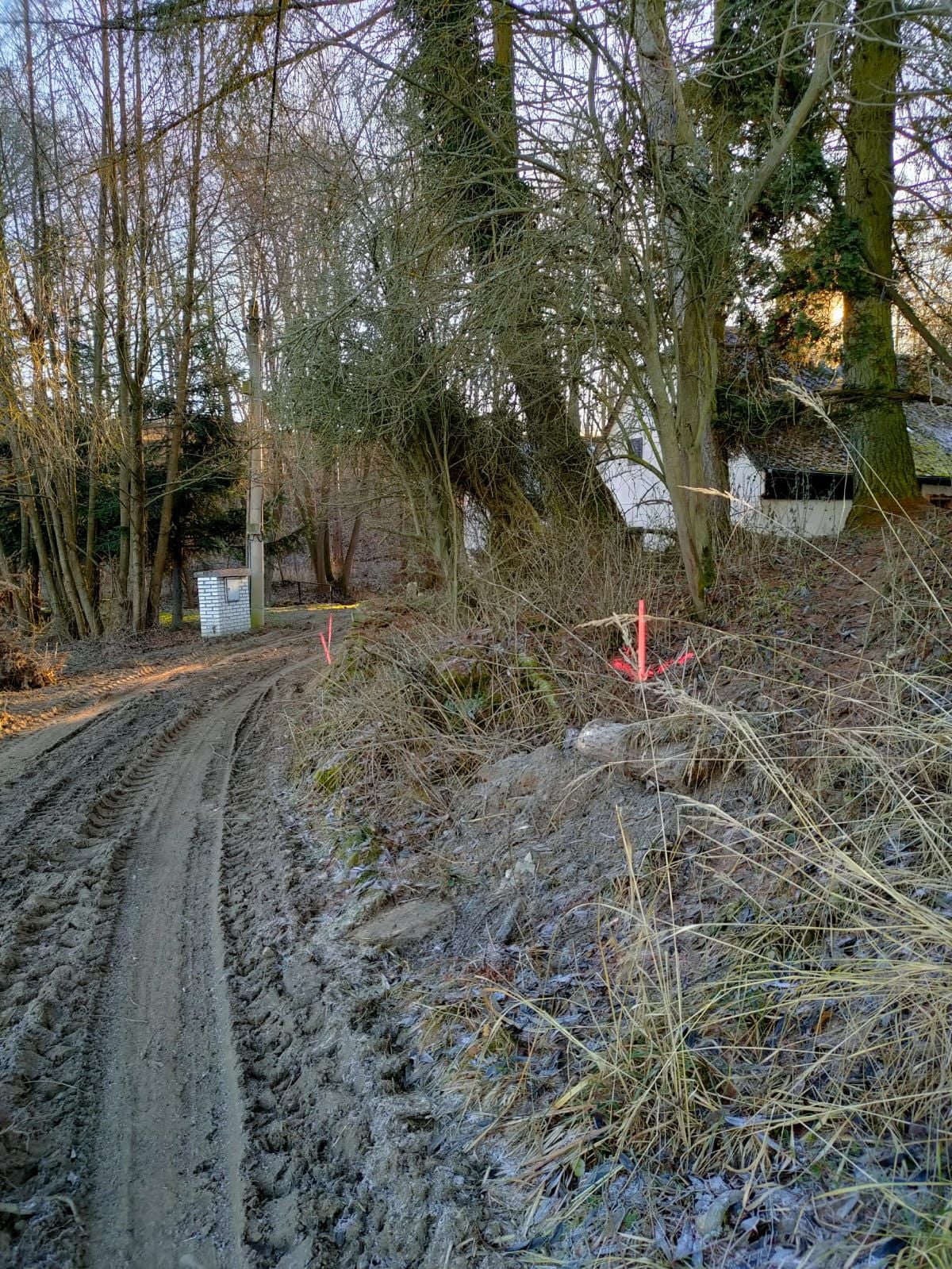
We invite the owners of all affected parcels to the setting out in writing. On the ground we fix the turning points with permanent markers (plastic boundary stones, nails, pipes set in concrete) and prepare a setting-out sketch with a report, a copy of which every invited owner receives.

Setting out a boundary does not in itself change the legal relations to the land. If you want to agree the course of the boundary with your neighbours in a binding way, we follow up with a cadastral survey plan (geometrický plán) based on the boundary as set out or as refined by the owners – the refined boundary is then recorded in the cadastre.
The boundary from the map back onto the ground

What it includes

What setting out covers

  • Setting out the turning points of the boundary on the ground

  • Informing the owners of the course of the boundary as set out

  • Fixing the points with permanent boundary markers

  • Preparation of the setting-out documentation (Setting-out sketch, setting-out report, list of coordinates, …)

  • Sending the setting-out documentation to the client, to all affected owners and to the relevant cadastral office

  • Optionally a cadastral survey plan to refine the boundary

  • Analysis of cadastral records and of earlier surveys

  • Written invitation of the owners of the affected parcels

Deliverables

Everything you receive

The boundary set out on the ground

Turning points fixed with permanent boundary markers.

boundary stones / nails

Setting-out report

Documentation of the setting out including the setting-out sketch; the affected owners receive a copy.

PDF / print

Cadastral survey plan (optional)

For recording a boundary refined by the owners in the Cadastre of Real Estate.

PDF + print

How it works

From order to a marked boundary

  1. 01

    Order and records

    We request the records from the cadastre and assess the quality of the boundary determination.

  2. 02

    Invitation of the owners

    We invite the owners of the affected parcels to the setting out in writing.

  3. 03

    Setting out on the ground

    We set out and fix the turning points and show the course of the boundary on site.

  4. 04

    Documentation

    We hand over the report with the sketch; if needed we follow up with a cadastral survey plan.

Common questions

What you ask us most.

You do not need the neighbours' consent for the setting out – they do, however, have the right to be invited and to be informed of the course of the boundary. Any objection is entered in the setting-out report (owners who are not present have the right to comment in writing to the surveyor carrying out the setting out within 10 days of the meeting; a binding refinement of the boundary is possible by means of a declaration of consent and a cadastral survey plan – we prepare the cadastral survey plan together with the declaration of consent and advise you on the cadastral entry).

The accuracy corresponds to the cadastral records. Where the boundary was established by precise survey, the setting out is accurate to within centimetres (depending on the identical points that have survived and on the internal accuracy of the original survey); for boundaries taken over from historical maps the determination may be less accurate – we explain all of this before you place the order.

No. Setting out does not change the legal relations to the land – the boundary is merely marked according to the recorded state. A change or refinement of the boundary in the cadastre is dealt with only by a cadastral survey plan together with the relevant deed.

Have a project where this fits?

Contact an expert

Robert Nekola

Robert Nekola

Head of cadastral plans

Cadastral survey plans and setting out
Setting out land parcel boundaries | GEOREAL